Hidden Swing Trail

(Palos Verdes Peninsula, CA)

★★★★☆

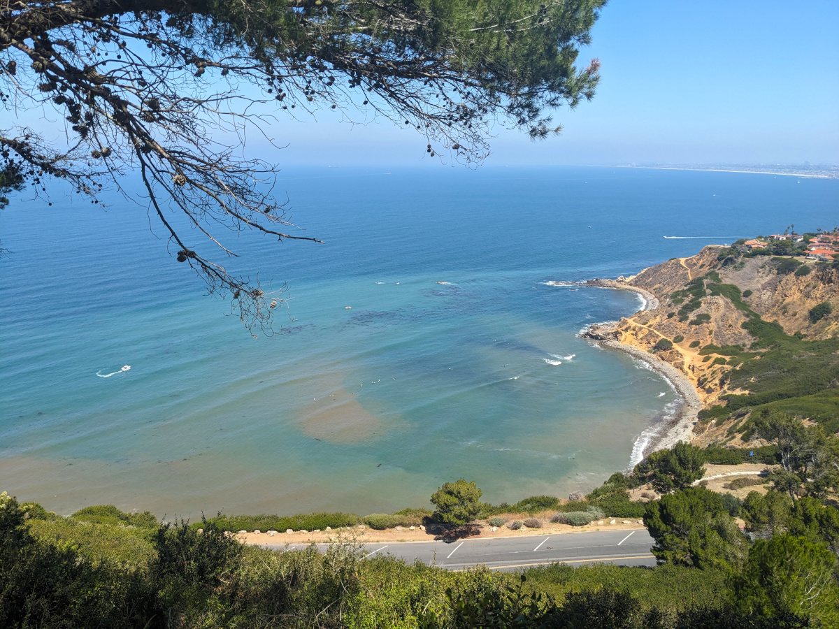
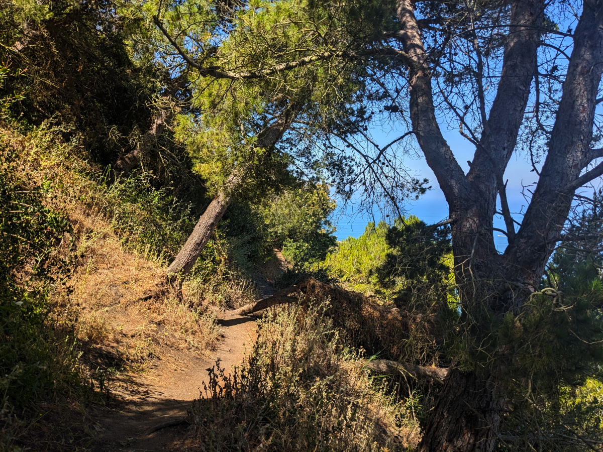
An unsigned hike along the coastal side of the hills on the west side of the Palos Verdes peninsula. A lot of it is just on the edge between trees and chaparral. In the morning there’s shade along most of the upper part of the trail. There isn’t much shade along the lower part, and probably not along the upper part in the afternoon. Nice views of the ocean and Bluff Cove. In a few spots, it cuts across narrow gullies that look like there might be narrow streams/waterfalls during the rainy season.

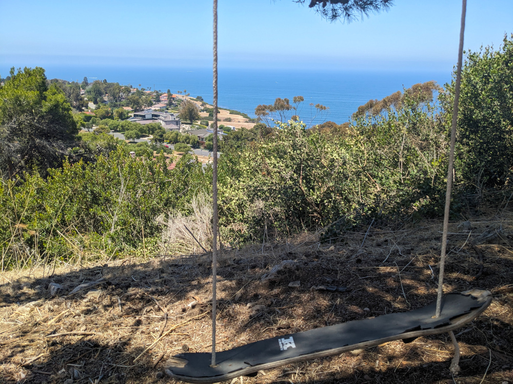
And yes, there is a swing someone made from an old skateboard.

Looking downhill past a makeshift swing toward a row of low trees, then houses in the distance, then the ocean. The swing is made from a skateboard, its wheels removed and a pair of ropes passed through the holes and tied off. It's not clear what it's hanging from, but the shadow on the ground (mostly dirt and twigs) implies it's a tree. Incidentally, I removed the GPS coordinates from this one. Looking down at the Pacific coast, flanked by pine branches. A paved road runs across the bottom of the frame, already far enough below that a full-sized tree looks the same size as a small plant in the shaded foreground. The road runs straight, but beyond it the coast curves away, forming several coves with rocky shores and a headland. Within the arms of the coves, the water is swirls of turquoise, blue and brown, with a few boat trails and some long wavefronts. Beyond it, the ocean is calm, flat, and blue. The steeper bluffs are mostly dirt, but the shallower parts (which look like they've slid down) are covered by low green bushes. A few houses are visible at the top of the headland. Haze obscures the horizon, but on one side you can see a thin strip of coastline in the distance.

There are stretches that have eroded, so step carefully, and there are steep sections (mostly close to the upper end) and tree roots. It’s very much not suitable for wheelchairs or anyone with limited mobility. Though I did see some kids on mountain bikes.

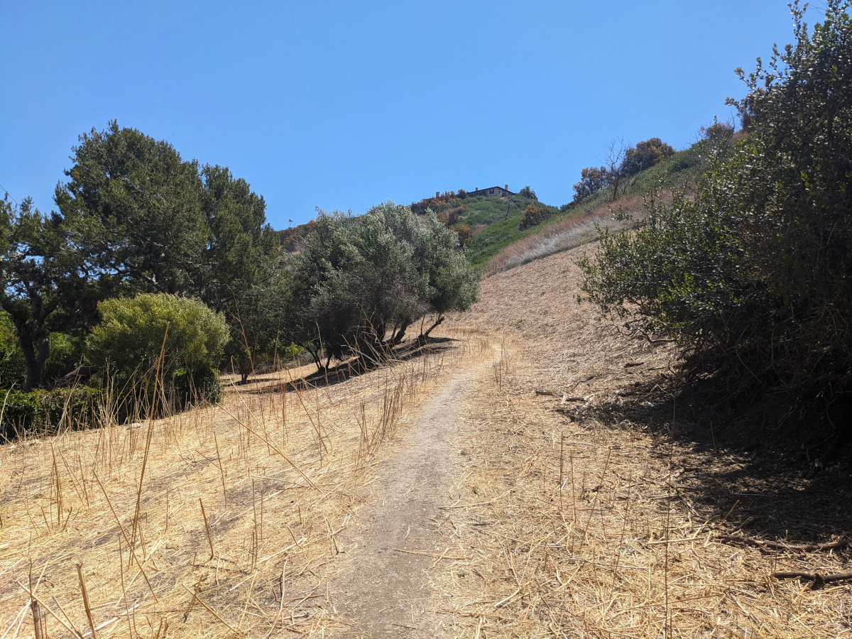
The upper end of the trail is in a very expensive-looking residential neighborhood, but there’s street parking. The lower end is at Palos Verdes Drive West, a bit south of the Bluff Cove parking area, though it’s less well-marked. If you start at the lower end, you’ll be coming back downhill. If you start at the upper end, you’ll be coming back uphill and finishing with the steepest part.

Start at the lower end. And bring water.

A narrow dirt trail winds through the stubble of dried grasses along a hillside between sprawling clusters of trees (olive, twisted pines, maybe some oaks) on a sunny day. In the distance, the upper parts of the hill are green, and a wide, flat house can be seen on the summit. The trail itself disappears behind one of those clusters of trees. A dirt trail winds along a hillside with mixed shade and sunlight. Sparse vines and other small plants dot the nearby hillside, and gnarled pine trees fill the shade. Just ahead, a narrow, straight pine tree is leaning over the trail at an angle, perpendicular to the hillside but way off of vertical. Below it, a branch (same tree? different one?) lies on the ground across the trail, its needles brown, dry and drooping. Through the pine branches, you can see the bright blue ocean and slightly lighter blue sky, though the horizon itself is obscured.

It’s part of a network of trails around the peninsula. There’s a 3-way fork with two paths going upward (one east, turning northward, and one south) and one going downward (west, turning southward). If you’ve started from the top, you’ll want to turn right/down/west at that fork to get to the swing. Left/up/south will eventually come back down to the same spot at PV Drive where the swing trail ends, and you can come back up that path. If you start at the bottom, you’ll want to go left/up/east to get to the upper end of the trail, or right/up/south to loop back to where you started.