Malaga Creek
(Palos Verdes Peninsula, CA)
★★★★★
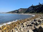
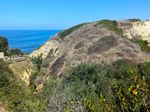
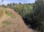
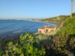
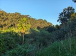
West of Palos Verdes Drive and downstream from Valmonte and Frog Creek Loop, Malaga Creek carves a canyon (not to be confused with Malaga Canyon up in the hills) through the coastal bluffs down to a narrow, pebbly beach. The canyon is too choked with trees to follow in most places, but an informal trail runs around the top of the canyon, climbing down to the creek in a few spots. A steep service road winds down from the bluffs on the southwest side down to Rat Beach (or rather RAT Beach, as in Right After Torrance) near the spot where the creek runs into the ocean.
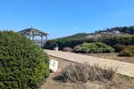
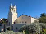
You can park on the street across from Malaga Cove Plaza, or along Via Almar. But it’s simplest to park at the former Malaga Cove School, now used as district offices.
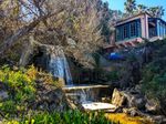
The octagonal bell tower at the southwest corner of the school building is nicely scenic, and worth checking out.
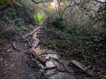
The trail is often overgrown, and while there’s shade on parts of the south side, the north side is mostly open. A smaller stream runs down the hill and joins the trail as it drops down to cross Malaga Creek itself, just above where the culvert below the road opens out. Locals have placed wooden boards along that stretch to make it easier to walk along it. The crossing itself can be muddy.
There are also a couple of connecting trails: One along the south rim connects to Via Corta near the triangular mini-park. Another just north of where it crosses connects to the much smoother walking/bike path that parallels the shoreward curve of Palos Verdes Drive from Malaga Cove Plaza to the church.
More info at Malaga Creek.